 |
|
|
|
|
|
|
| |
 |
|
| |
|
 |
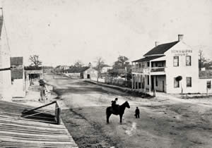
1866 |
|
[PICA 01971] enlarge image
|
|
| |
|
|
|
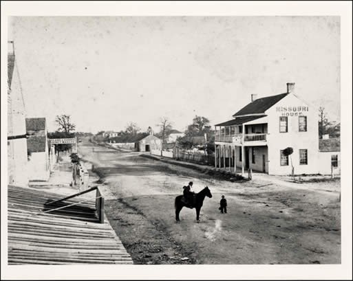
Looking east along Pecan Street, as it was previously called, just west of the Brazos Street intersection. Pecan Street began as the main thoroughfare into town (a nice flat trail) for the farmland communities to the east, and soon became a major commerce district. By the 1860s, log and frame houses, wagon yards, livery stables, and saloons were present along Pecan Street, as were pigs and cows from time to time. |
|
| |
|
|
|
|
|
| |
|
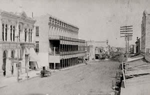
1879 |
|
[PICA 01977] enlarge image
|
|
| |
|
|
|
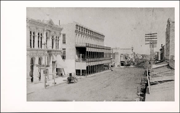
Looking east from Colorado. The arrival of the railroad to Austin in 1871 brought a commercial boom that gave rise to a number of limestone Victorian buildings as well as an "East 6th" cluster of African-American businesses. |
|
| |
|
|
|
|
|
| |
|
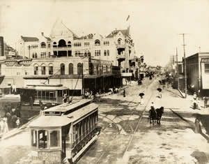
c.
1909 |
|
[PICA 19984] enlarge image
|
|
| |
|
|
|
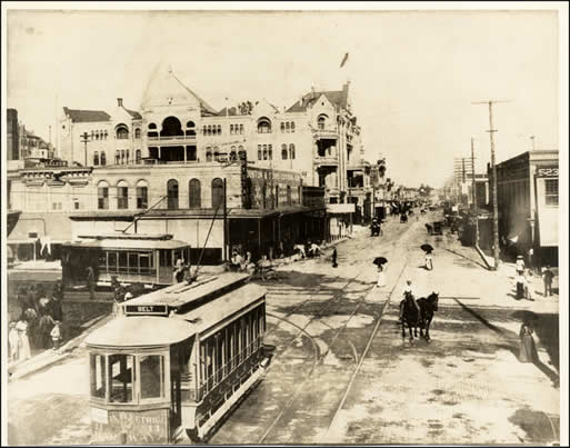
Looking east toward the busy intersection of 6th and Congress, just prior to the 1910 construction of the Littlefield Building (note the women carrying parasols for protection against the afternoon sun). |
|
| |
|
|
|
|
|
| |
|
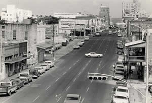
1970s |
|
[PICA 28344] enlarge image
|
|
| |
|
|
|
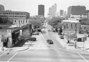
An elevated westward view from the IH-35 overpass, shortly after 6th Street was changed to a one-way thoroughfare, and just before revitalization efforts were launched in the mid-70s. |
|
| |
|
|
|
|
|
| |
 |
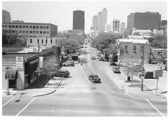
1998 |
|
[PICA 31609] enlarge image
|
|
| |
|
|
|
|
Looking west from the IH-35 overpass.
|
|
| |
|
|
|
|
|
|
| |
|
|


